


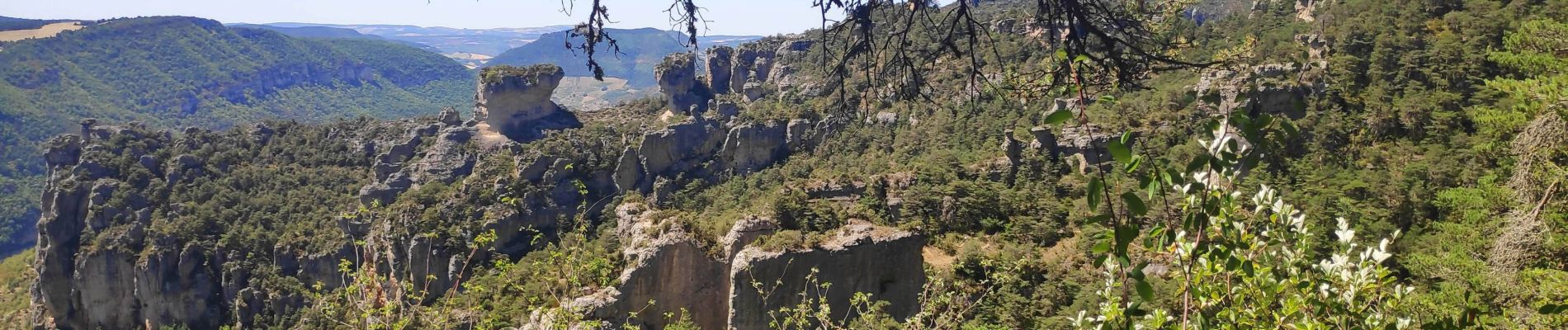
corniche du Tarn et de la Jonte

gdela
User
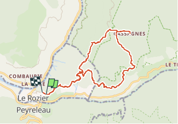

Length
11.4 km

Max alt
884 m

Uphill gradient
663 m
Km-Effort
20 km

Min alt
495 m

Downhill gradient
678 m
Boucle
Yes
Creation date :
2022-07-26 07:40:32.315
Updated on :
2022-07-26 13:52:48.302
3h51
Difficulty : Medium

FREE GPS app for hiking
 SityTrail
IGN / Geographical institutes
SityTrail Plus
The world is yours!
About
Trail Walking of 11.4 km to be discovered at Occitania, Lozère, Le Rozier. This trail is proposed by gdela.
Description
magnifique
Photos


Positioning
Country:
France
Region :
Occitania
Department/Province :
Lozère
Municipality :
Le Rozier
Location:
Unknown
Start:(Dec)
Start:(UTM)
516984 ; 4893218 (31T) N.
Comments